

I’ve been collecting places to fly in Nigeria for a while now: spots where you can get nice shots, places where you can rip your drone in peace, and scenic ones for cinematic footage. A few are on my own list to fly, and most come from pilots in the Nigerian drone community who’ve already been out there filming. Where someone’s footage put a spot on my radar, I’ve credited them.
Apo–Karshi Road, Abuja — a hill reveal with a road in the frame
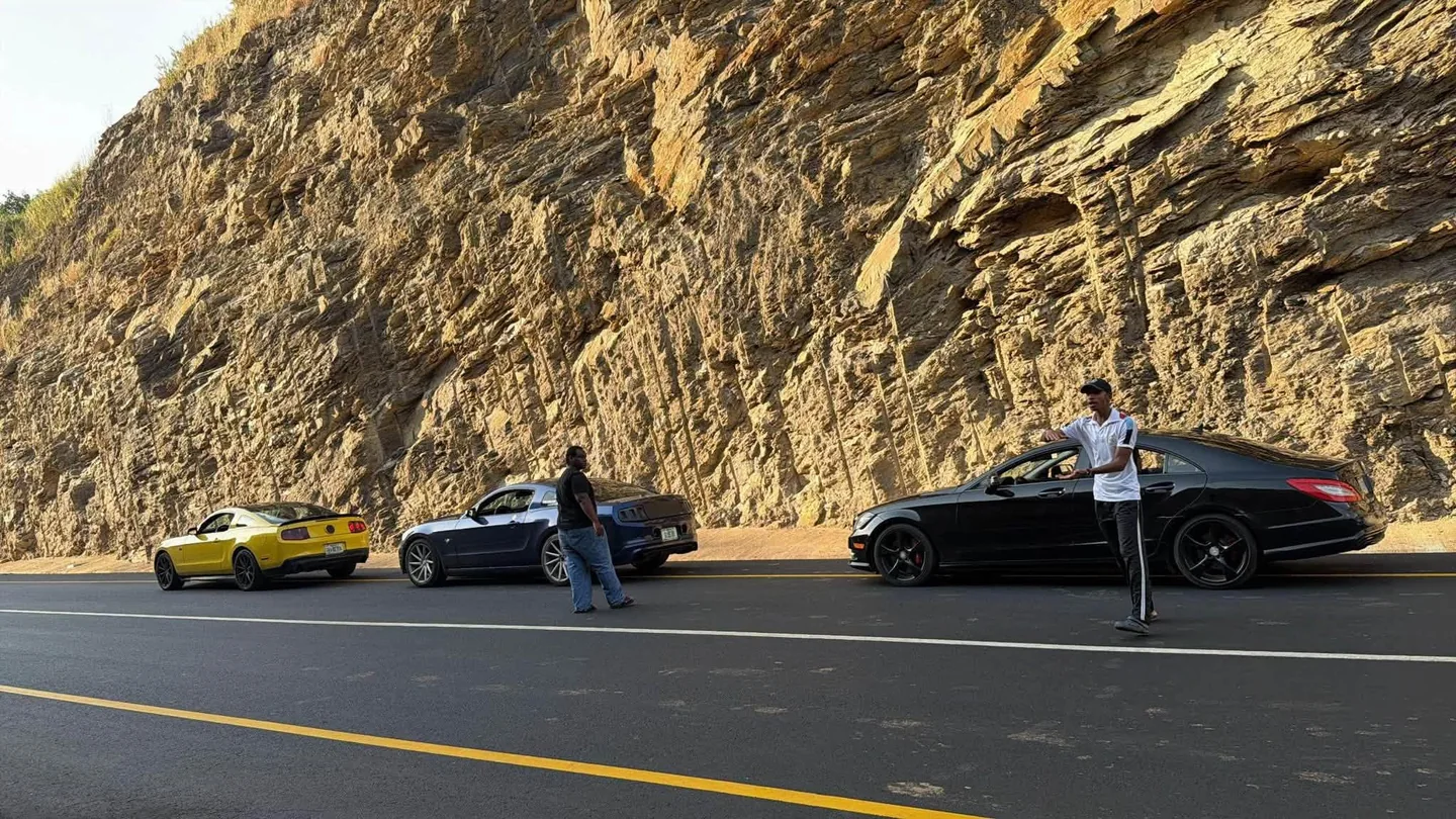
Apo–Karshi Road, Abuja.
This one came from Adiya Media’s footage. The paved stretch is open and people are already driving it. From above, the road winds between two steep cut slopes and the lane markings pull your eye through the bend, which is exactly the kind of reveal I love. Apo–Karshi Road on Google Maps
The abandoned airplane site, Idu Industrial Area, Abuja
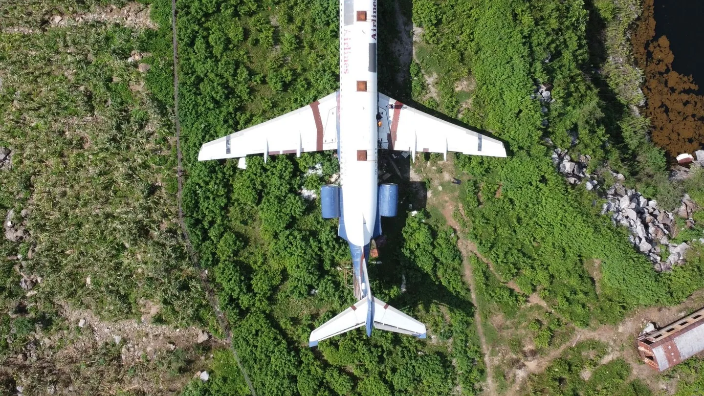
Abandoned airplane near Abuja. Photo via Pexels.
@iamjunior.ng put this one on my radar. There’s an airplane fuselage sitting on concrete supports beside a pool and a steep rock face. Go wide first so people get the scale, with the wings stretched across the greenery and the rock framing the water behind them.
See the airplane site in the original Instagram reel
Moshood Abiola National Stadium, Abuja
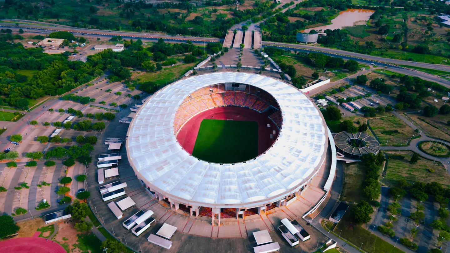
Photo by Victor Zaviano via Wikimedia Commons, CC BY-SA 4.0.

Adiya Media again, this time with an overhead shot where the oval roof, red running track and pitch all fit in one frame.
Bandos — where to get concrete, columns and clean lines
A bando is an abandoned building or industrial site, and it’s where FPV really shines. Open bays, doorways and rows of concrete columns give your footage depth as the foreground rushes past the background.
Oyo-Ile, Old Oyo National Park. It isn’t concrete, but the old defence walls and what’s left of the Alaafin’s palace give you a completely different texture, with low wall fragments and vegetation shaping the ruins.
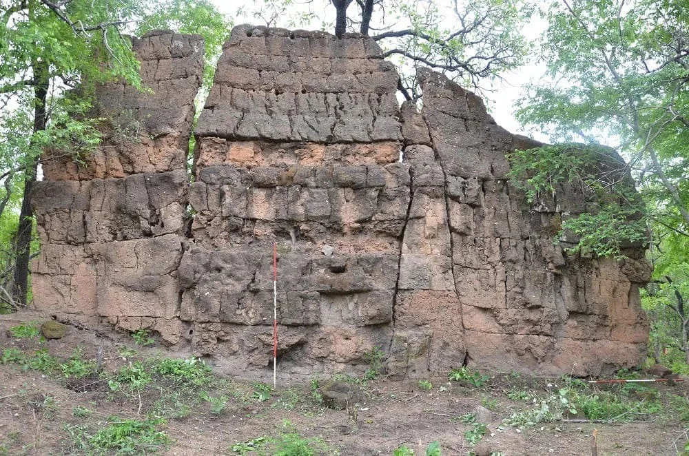
Old Oyo wall ruins. Photo by Ifecenticpolity via Wikimedia Commons, CC BY-SA 4.0.

Old NEPA Building, Ijora Olopa, Lagos
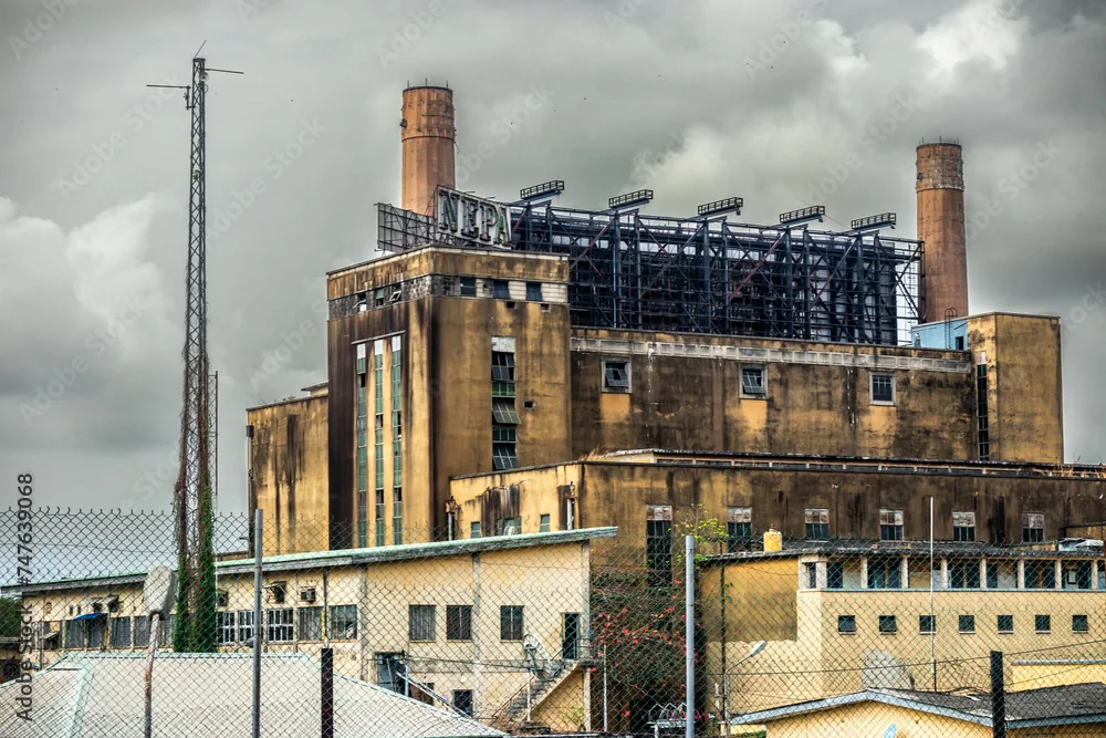
Old NEPA Building, Ijora Olopa.
I first saw this one in FPV footage by Kome Edegbo (@komefpv). The chimneys and the exposed roof framing make it one of the bandos I most want to fly. Kome Edegbo on TikTok
Old Federal Secretariat, Ikoyi, Lagos
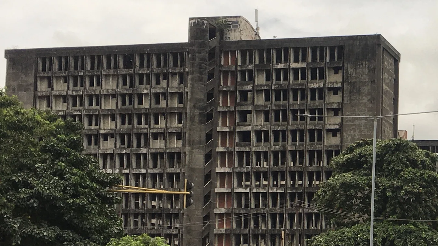
Photo by Beendy234 via Wikimedia Commons, CC BY-SA 4.0.

The old Federal Secretariat in Ikoyi is a huge concrete face with rows and rows of recessed windows. That repetition is what makes it work on camera, and shooting the front straight on shows off the scale.
Abandoned Iyana Era Building, Lagos
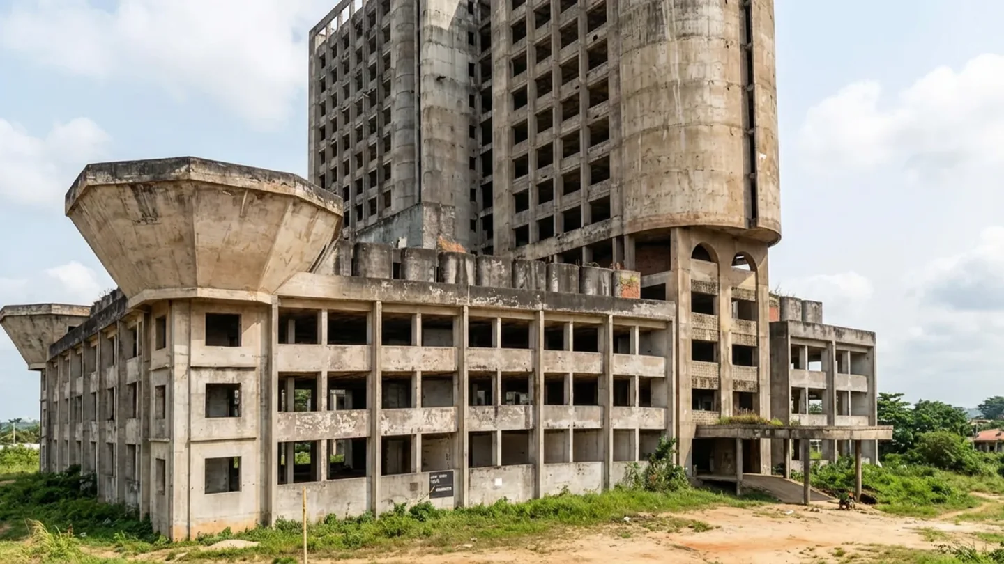
Abandoned building at Iyana Era.
Most people call it Ile Nla. It’s the unfinished former National Provident Fund building near the Lagos–Badagry Expressway, with open window bays running up the tower and chunky concrete wings at the bottom.
Open grounds and coastal shots in Lagos
Eko Atlantic City
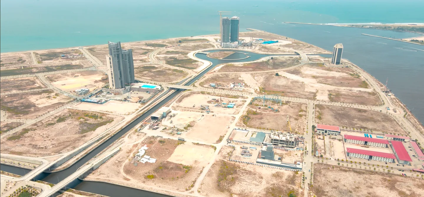
Eko Atlantic from above. Drone shot by Ekingz Visual.
Ekingz Visual’s shot shows why this place is on the list. The coastal road gives a wide shot a line to follow, with the skyline on one side and the ocean on the other. Eko Atlantic
NECOM House, Marina, Lagos Island
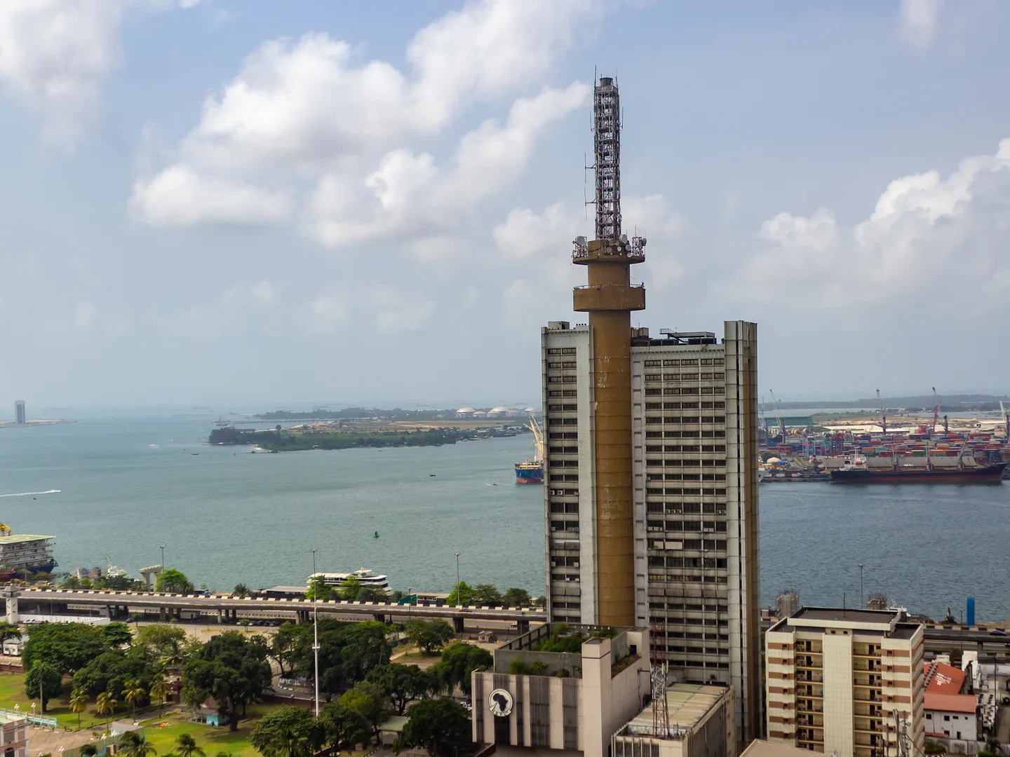
NECOM House reference photo by Juganutt via Wikimedia Commons, CC BY-SA 4.0.

In Kome Edegbo’s footage, the round platforms under the rooftop mast stand out against the blue sky, with a Guinness billboard on the building below. You might know it as the old NITEL Building. Kome Edegbo on TikTok
National Stadium, Surulere
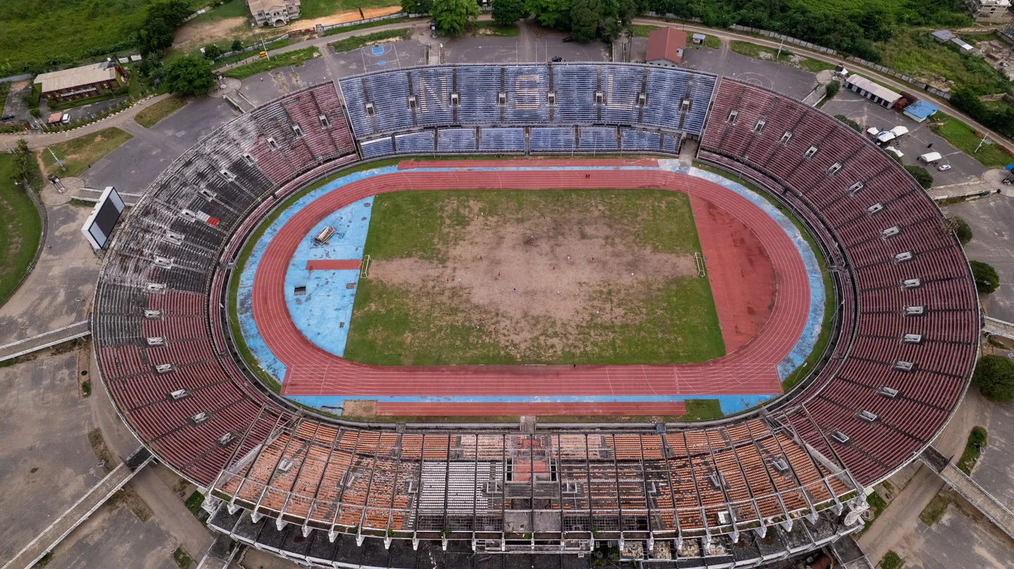
Photo by Isaacayodele32 via Wikimedia Commons, CC BY-SA 4.0.

The open grounds around the stadium give you room to frame the bowl and stands, and a wide shot shows how the whole complex sits in Surulere.
Tarkwa Bay Beach
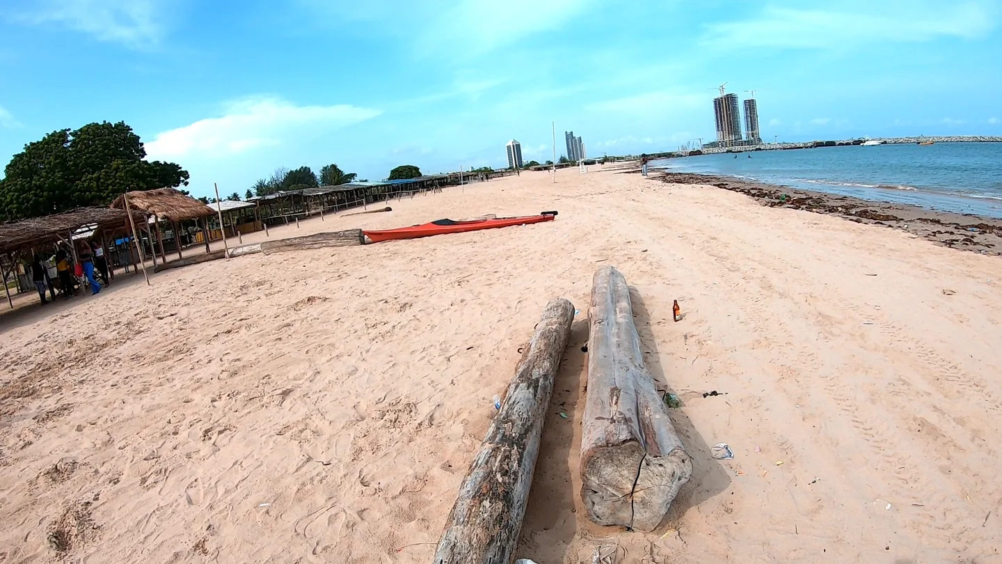
Tarkwa Bay Beach. Photo by Liesel81 via Wikimedia Commons, CC BY-SA 4.0.

Tarkwa Bay is a sheltered beach at the mouth of Lagos Harbour. The curve of the sand gives you a natural line through the shot, with the breakwater and passing ships in the background.
Lagos Polo Club, Ikoyi
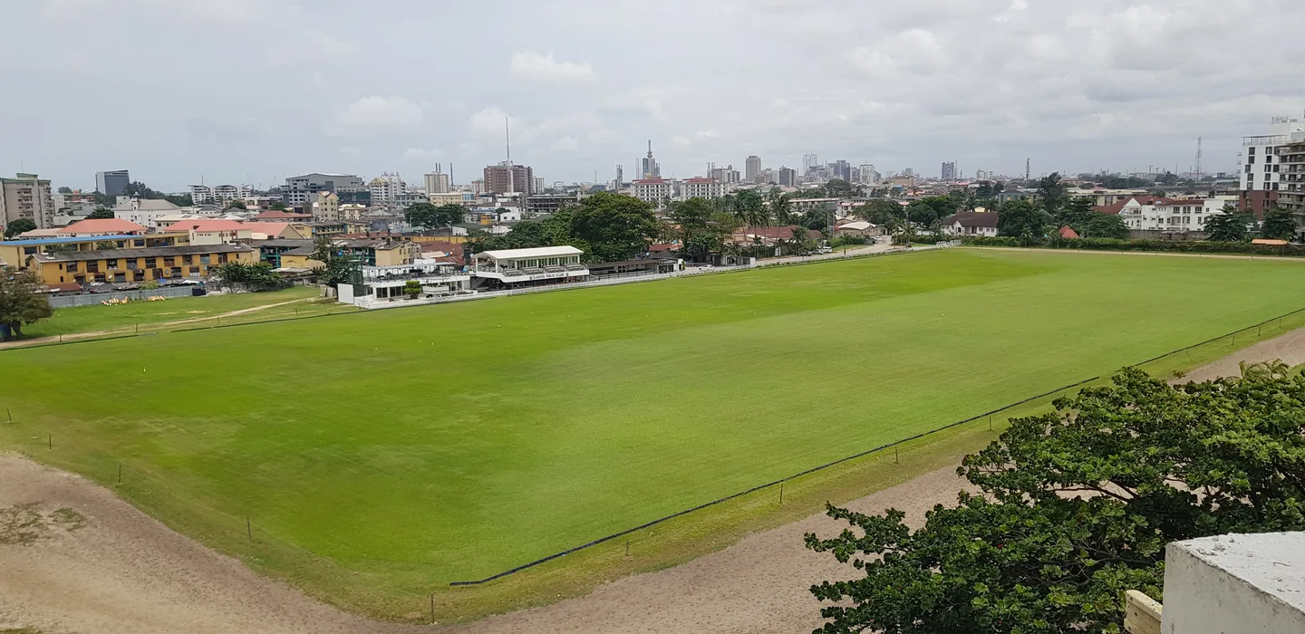
Lagos Polo Club field. Photo by Kofash1993 via Wikimedia Commons, CC BY-SA 4.0.

The big grass field and its markings make a clean, simple frame, a patch of green right in the middle of the city.
Scenic routes and landmarks
Lekki–Ikoyi Link Bridge, Lagos
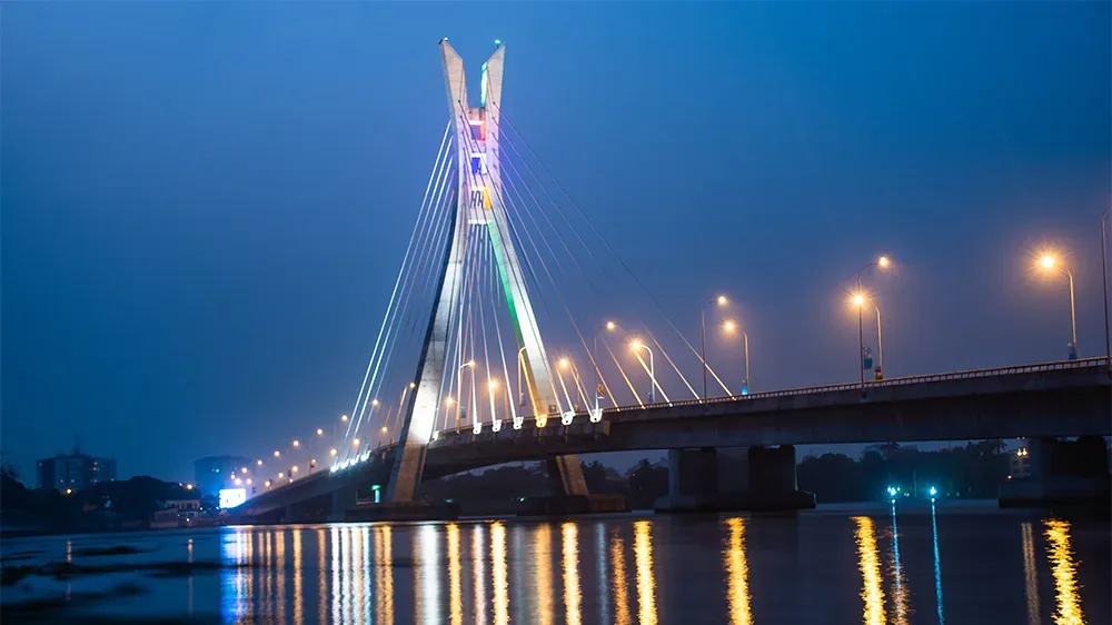
Lekki–Ikoyi Link Bridge at dusk. Photo by Olasunkanmiariyo via Wikimedia Commons, CC BY-SA 4.0.

The cable-stayed bridge between Lekki Phase 1 and Ikoyi looks best wide from the shoreline, especially when the evening light hits the lagoon and the cables fan out above the deck.
Abuja City Gate, FCT
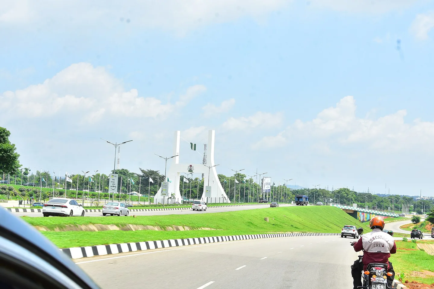
Abuja City Gate. Photo by Mr Trinity001 via Wikimedia Commons, CC BY-SA 4.0.

This is the classic “welcome to Abuja” shot. The monument and the road leading into the capital make a strong opening shot for any Abuja video.
Eleyele River and Dam, Ibadan, Oyo State
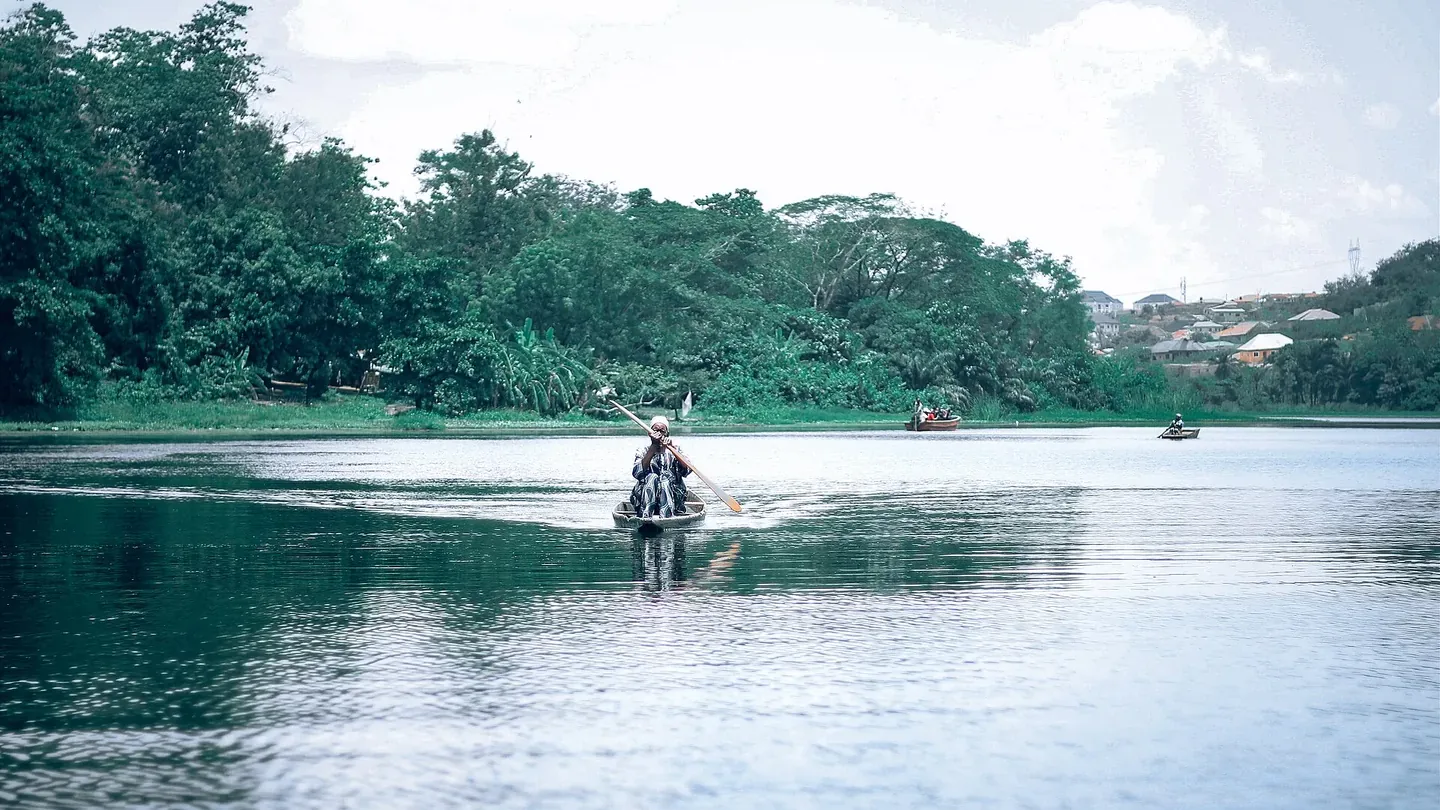
Eleyele River, Ibadan. Photo by Adeoluwa Olatunji via Wikimedia Commons, CC BY-SA 4.0.

Eleyele is a reservoir on the Ona River, ringed by woodland. The edge where the trees meet the water gives a wide frame some shape.
Lagos Blue Line Rail, Marina to National Theatre
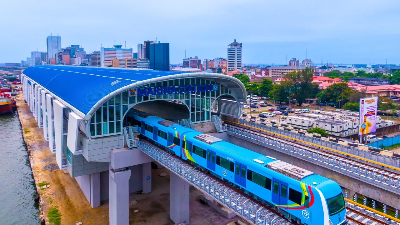
Blue Line Rail. Photo via Twitter, as credited by The Guardian.
Between Marina and National Theatre, the Blue Line runs on elevated tracks across the water. Catch a train passing against the skyline and you’ve got movement built into the shot. The train schedule helps you time it.
National Theatre, Iganmu, Lagos
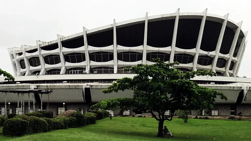
National Theatre in 2015. Photo by dotun55 via Wikimedia Commons, CC BY-SA 2.0.

The roof is shaped like a military cap, and a wide view shows off that profile above the open grounds around it, with the Blue Line nearby as a bonus. It’s been refurbished and renamed the Wole Soyinka Centre for Culture and the Creative Arts.
Idanre Hills, Ondo State
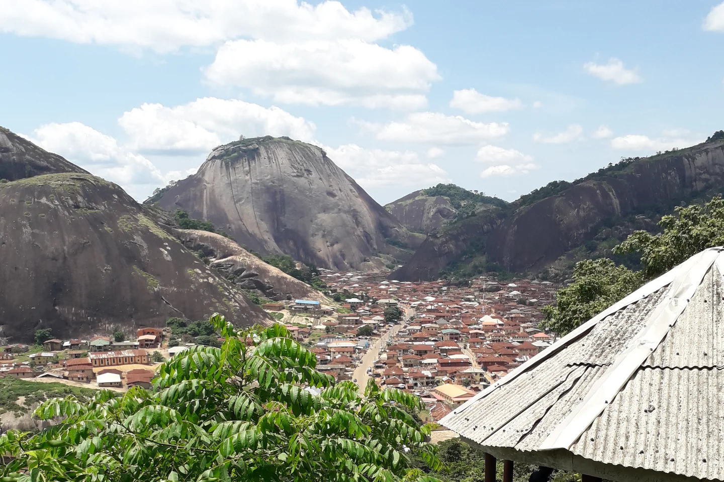
Idanre town and surrounding hills. Photo by Jombo12 via Wikimedia Commons, CC BY-SA 4.0.

Steep rock faces, valleys and an old hilltop settlement. Put a rock face in the foreground and let the valley open up behind the ridge.
Erin-Ijesha Waterfalls, Osun State
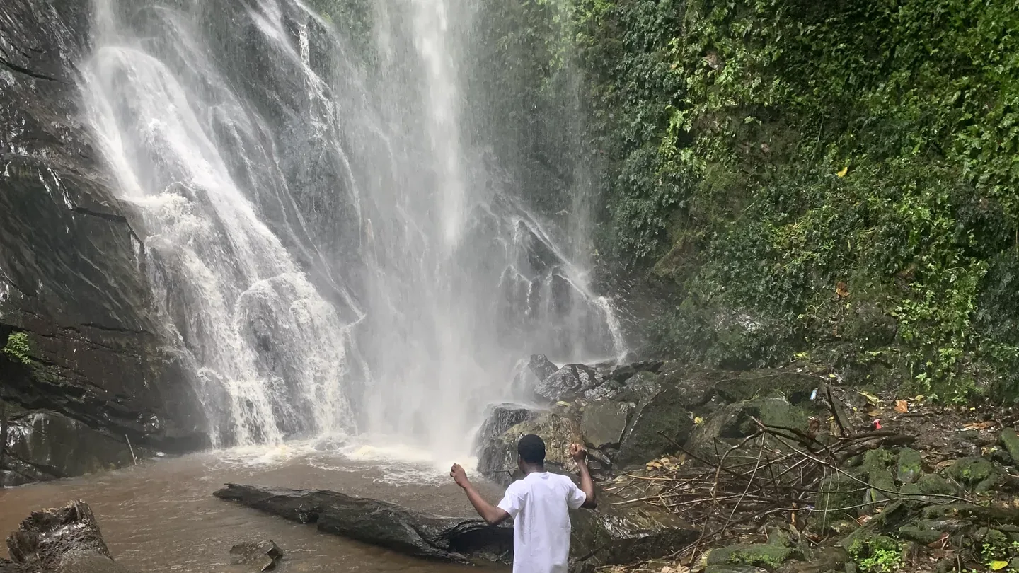
Erin-Ijesha Waterfalls. Photo by Chic portfolios via Wikimedia Commons, CC BY-SA 4.0.

Olumirin, as it’s also called, gives you moving water, dark rock and layers of green in one frame. Start wide to show the whole cascade against the rock face.
Rocks and hiking spots to scout
Zuma Rock, Niger State
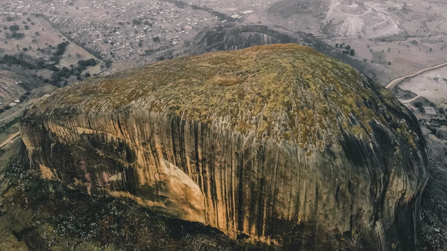
Zuma Rock from above. Photo via Pexels.
Zuma Rock towers over the land near Suleja. It works best as a distant subject, with the landscape around it in frame to show just how big it is.
Olumo Rock, Abeokuta, Ogun State
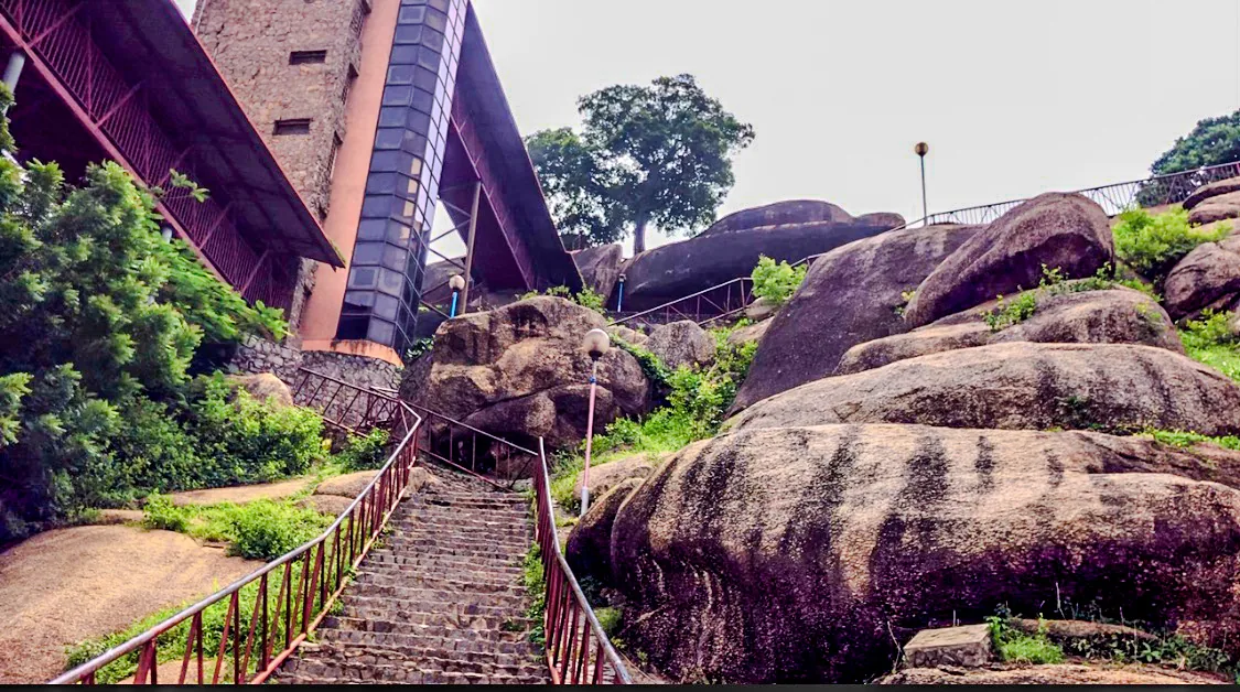
Stairway at Olumo Rock. Photo by Dammyjay101 via Wikimedia Commons, CC BY-SA 4.0.

The stairway up Olumo opens onto views across Abeokuta, and the granite with the rooftops below makes a great wide shot. The climb itself is worth filming too.
Ngwo Pine Forest and Okpatu Hill, Enugu State
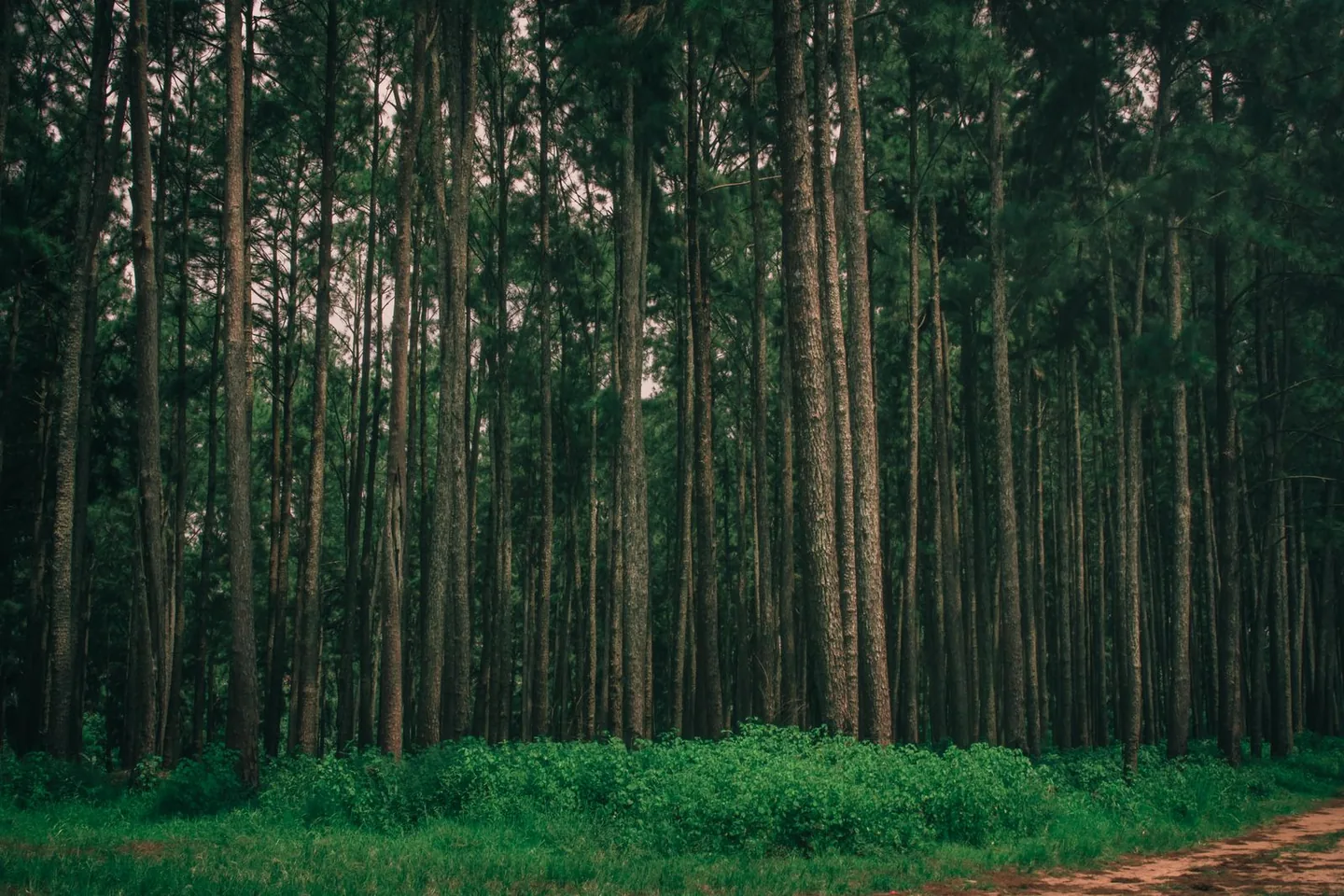
Ngwo Pine Forest. Photo via Pexels.
Tall pines and a walk into limestone terrain. For a big open panorama, head up Okpatu Hill, which looks out over the Enugu landscape.
Ogbunike Caves and Agulu Lake, Anambra State
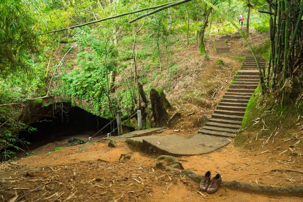
Ogbunike Cave entrance. Photo by Dotun55 via Wikimedia Commons, CC BY-SA 4.0.

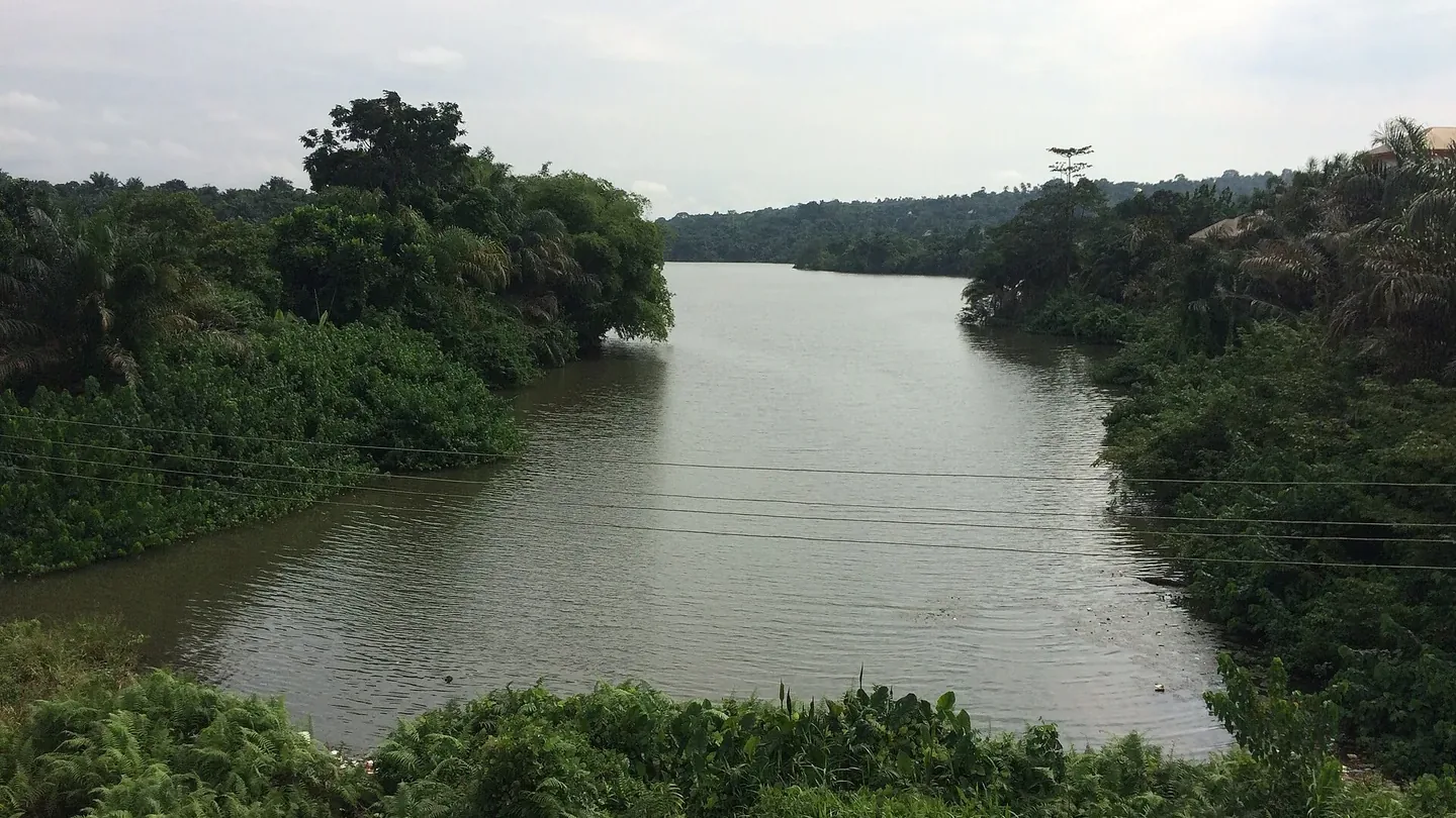
Agulu Lake. Photo by Okechukwu4u via Wikimedia Commons, CC BY-SA 4.0.

Ogbunike has steps winding down through the forest to the cave entrance. If you want open water, Agulu Lake is a separate stop with plenty of room for the shoreline and the landscape around it.
More waterfalls to scout for FPV
Gurara Falls, Niger State
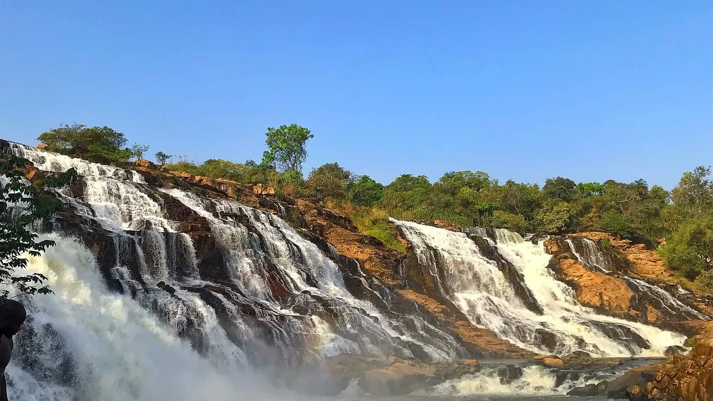
Gurara Falls. Photo by Tytypicasso via Wikimedia Commons, CC BY-SA 4.0.

The water spreads across a broad rock ledge, so open with a wide reveal.
Owu Falls, Kwara State
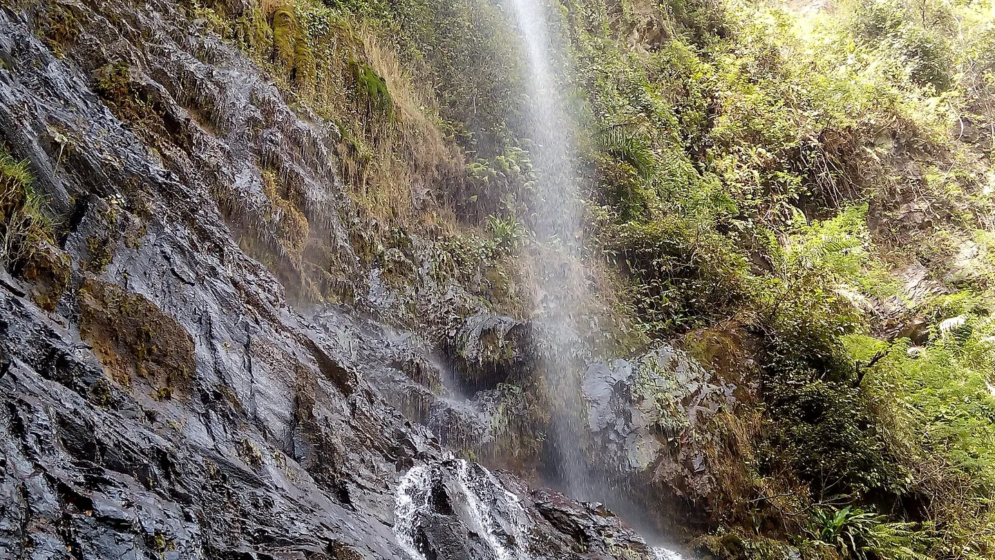
Owu Falls. Photo by Godwin Oluyomi via Wikimedia Commons, CC BY-SA 4.0.

A long drop into the pool below makes for a strong vertical shot. Pull back far enough and you can show the full height in one frame.
Awhum Waterfall, Enugu State
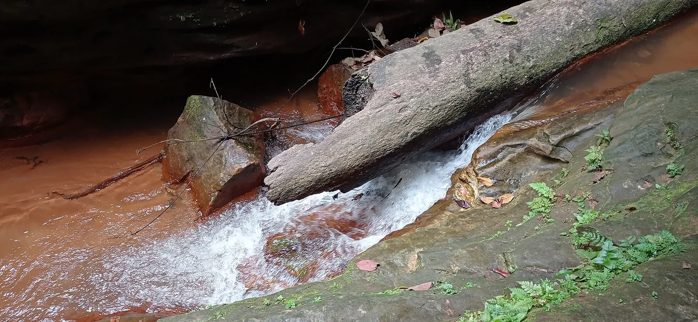
Awhum Waterfall. Photo by Favouridowu via Wikimedia Commons, CC BY-SA 4.0.

The red rock and greenery around the falls are as much of the shot as the water itself.
Ogba Cave and Waterfall, Owerre-Ezukala, Anambra State
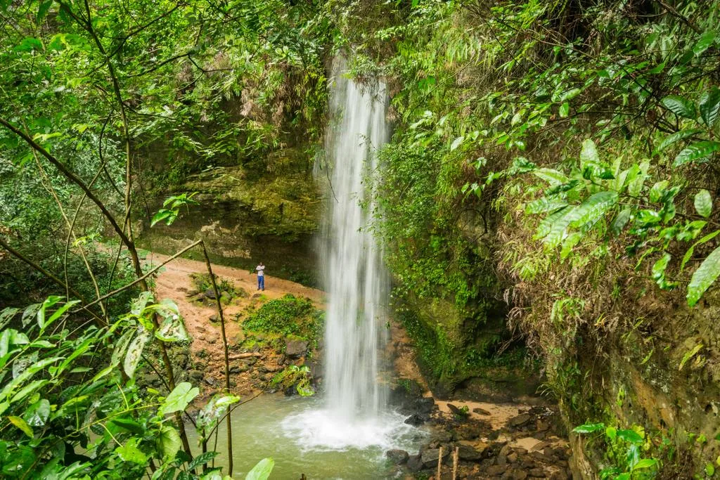
Ogba Waterfall. Photo by Dotun55 via Wikimedia Commons, CC BY-SA 4.0.

The cave and the falls sit together here, and the outside is the part to scout for an aerial establishing shot.
Agbokim Waterfalls, Cross River State
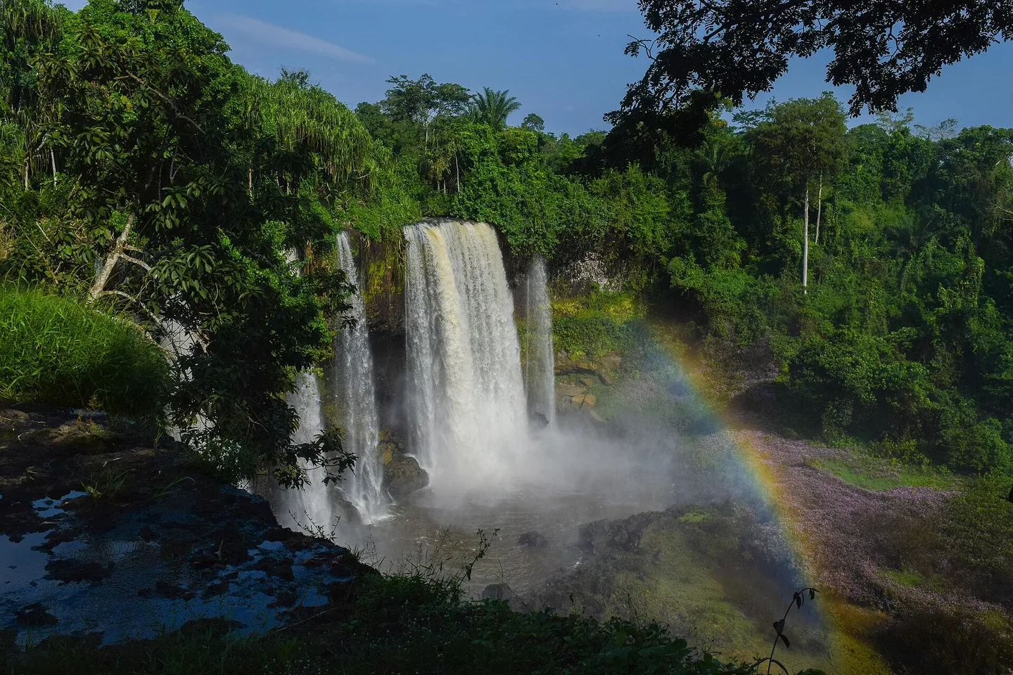
Agbokim Waterfalls. Photo by Ei'eke via Wikimedia Commons, CC BY-SA 4.0.

Several cascades surrounded by forest, and if you catch the light right, a rainbow in the spray.
Goldmine spots — one location, several shots
Araromi Seaside, Ilaje, Ondo State
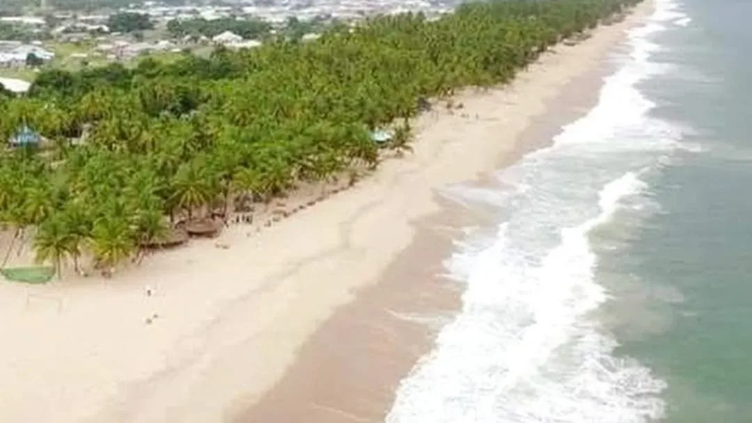
Araromi Beach. Photo by Eniola Ilaje via Wikimedia Commons, CC BY-SA 4.0.

Araromi gives you several shots on the same stretch of coast. Fly low on the land side for the sand and horizon, then climb and the surf line becomes the strongest shape in the frame.
An open farm or private field near you
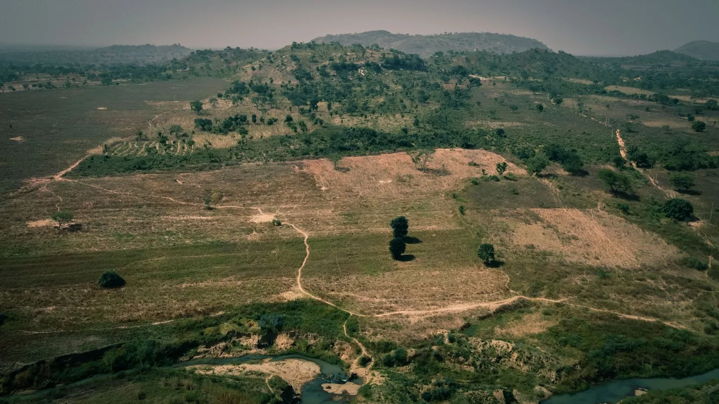
Farmland near Abuja. Photo via Pexels.
Honestly, this is where I’d start. An open field gives you room to get comfortable with turns, and a field edge, crop rows or a single tree gives you something to frame around when you practise reveals.
Before you head out
A few things I keep in mind before flying any of these:
- Stay clear of no-fly zones. Keep well away from airports and restricted areas, and sort out your clearance before the day. My first-flight guide walks through it.
- Ask whoever runs the place. Some of these spots are private, like Eko Atlantic and the Polo Club, and others are busy public landmarks, like City Gate and the stadiums. Seeing someone else’s footage doesn’t mean you can just turn up and fly.
- Walk the spot first. Look out for wires, loose materials, wind and blind corners, and pick a clear place to land.
- Bring a spotter. With goggles on you can’t see the drone, so have someone keep an eye on it and on the sky around you.
FPV pilots, where have you flown in Nigeria? If you’ve flown somewhere worth sharing or know a spot I should look into, send me the location and what makes it interesting. If you have a clip, send that too. I’d love to add more spots from across Nigeria to this guide. DM me on Instagram or share it in the Naija Drones community on Telegram.